Boundary surveys measure the boundaries and limits of a parcel, easement, or legal description by researching records and using GPS and RTS technologies. Clear boundary lines are important per WA state law. After research, we perform fieldwork to set markers and stakes as well as offer the option to walk the property with us to identify boundaries and any discrepancies.
While most land has already been surveyed at one time or another, the boundary lines can become confused over time, owing to anything from physical changes in topography to subdivisions of the land, and even neighbors who encroach on the borders.
commercial buying/selling
Inaccuracies in a property survey can harm your ownership rights when challenged. For commercial properties, lenders and title companies require a new survey before closing a sale to avoid this issue.
residential landowners
Get a boundary survey to clarify property boundaries for new development or in cases of neighbor disputes, land easement confusion, or uncertainty about parcel size.
types of
boundary surveys
Boundary surveys vary in type and each has unique benefits according to individual needs. It is crucial to comprehend these differences to make an informed decision.
existing lines survey
Clarifies and maps a property's existing/recorded boundaries, reporting and placing markers (if desired) at property corners.
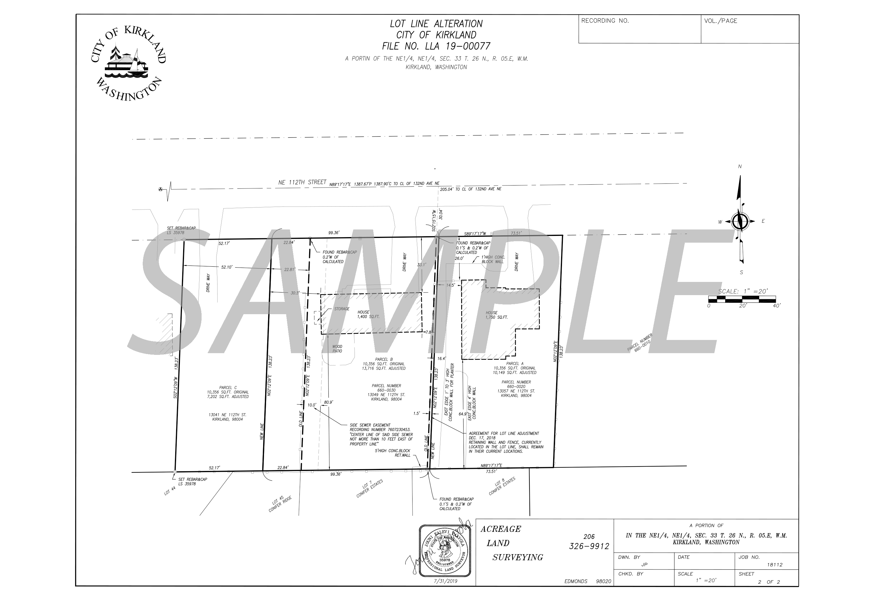
boundary/lot adjustment
Adjusting a boundary line between two legal parcels is a process sought by landowners without dispute, often for land use purposes.
encroachment survey
Involves investigation and
retracement of boundary lines when there is potential for illegal physical intrusion of a structure/property from one parcel to another.
cadastral survey
Sets land boundaries or subdivisions for public land ownership and management decisions.
